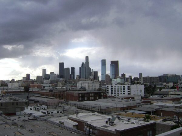
Another storm system pushed into the already saturated Southland Wednesday, leading to a wet morning commute and raising fears of mud and debris flows, and forecasters said another wave of rain will arrive later in the day and continue into Thursday.
“Phase one of the storm has moved into L.A. County this morning which is right on schedule,” according to the National Weather Service. “Overall the storm has behaved very much as expected. Rain amounts have been averaging between a half and one inch. A little less in some (areas) and a little more in others.”
Forecasters said the snow level had fallen to about 4,000 feet Wednesday morning, bringing a mix of rain and snow to higher elevations.
The latest round of rain again increased concerns about already-saturated ground giving away in the form of mudslides. The Los Angeles Fire Department responded shortly after 8 a.m. to a roughly quarter-acre mudslide in the Beverly Crest area that blocked at least two residential driveways.
Building and Safety crews were dispatched to the scene to assess any potential danger to homes in the area.
By late morning, the rain is expected to taper off in Los Angeles County, with some sunshine expected. But it won’t last long.
According to the NWS, there will be “increasing showers and possible thunderstorms (Wednesday night) into Thursday morning as the upper low with the colder and more unstable air mass moves through.”
The second wave of the storm is expected to be more “showery” in nature, dropping more rain in some areas than others, so rainfall totals are difficult to predict, forecasters said.
But snow could become an issue in northern Los Angeles County.
“Snow showers are likely on the Grapevine tonight into Thursday morning with light accumulations possible as snow levels fall to as low as 3,500 feet,” according to the NWS.
A winter storm warning will be in effect until 2 p.m. Thursday in the eastern San Gabriel Mountains, with 6 to 12 inches of snow possible above 5,000 feet. Forecasters said some higher peaks could see up to 18 inches, with the snow accompanied by winds gusting up to 45 mph.
The western San Gabriel Mountains and Antelope Valley (14) Freeway corridor will be under a winter weather advisory until 2 p.m. Thursday, with 4 to 8 inches of snow possible above 5,000 feet. The advisory will also be in place during the same hours for the Golden State (5) Freeway corridor in northern Los Angeles County, where an inch of snow could fall on the Grapevine.
The storm system is expected to move out of the area by late Thursday, with dry but cool conditions anticipated for Friday and the weekend.