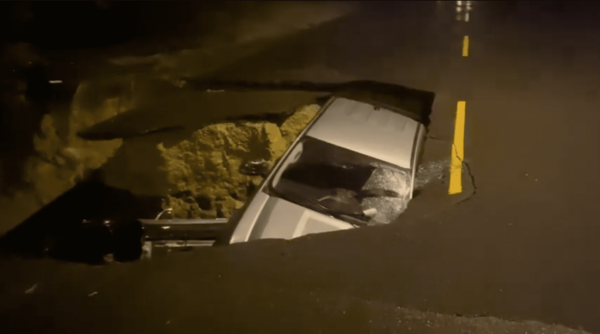
Rain fell across Southern California again Monday as yet another storm system moved over the region, prompting high winds, flood watches and evacuation warnings for some residents.
Flood watches were in effect from late Monday through Tuesday evening for the Los Angeles County coast, mountains, downtown Los Angeles, the San Fernando, Santa Clarita, San Gabriel and Antelope valleys and inland areas including Hollywood, Compton, Long Beach, Pomona, Downey, Norwalk, East Los Angeles, Culver City, Lakewood and Beverly Hills.
A flash flood warning was issued for Southwestern Los Angeles County through midnight Monday as heavy rain fell, bringing between 1 and 2 inches as of about 6:30 p.m., with another 1 to 2 inches possible in the area.
Flash flooding could occur in Long Beach, Thousand Oaks, Malibu, Beverly Hills, Universal City, North Hollywood, Hollywood, Van Nuys, Burbank, Santa Monica, Culver City, Northridge, Downtown Los Angeles, Inglewood, Woodland Hills and Chatsworth.
A flood watch also was in effect in Orange County’s coastal areas, inland areas including Santa Ana, Anaheim, Garden Grove, Irvine, Orange, Fullerton and Mission Viejo, and the Santa Ana Mountains and foothills.
While rain fell across much of the area overnight and into Monday afternoon, the brunt of the storm system was expected to arrive late Monday and into Tuesday, according to the National Weather Service.
“There will be periods of heavy rain, strong winds, flooding and a chance of strong thunderstorms,” according to the NWS.
Rainfall amounts were on track for 2-4 inches for the coast and valleys, and up to 4-8 inches in the mountains, forecasters said. According to the NWS, the storm brought 1 to 2 inches of rain that had already fallen near the Los Angeles/Ventura county line by early Monday afternoon.
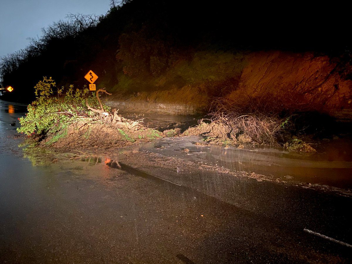
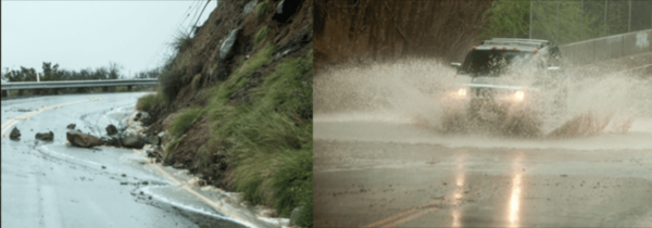
“Biggest concern continues to be near the recent burn scars, though all areas will be susceptible to at least minor flooding issues through early Tuesday,” according to the NWS.
Due to the threat of flooding and debris flows in recent burn areas, Los Angeles County officials issued an evacuation warning for residents in the Lake Hughes and Kings Canyon area that will be in effect through Tuesday. Residents were warned to prepare to evacuate by gathering important materials and being ready to leave quickly.
The city of Duarte issued a “yellow alert” for residents of roughly 25 homes near the Fish Fire burn area starting at 4 p.m. and continuing through 6 p.m. Tuesday. The alert imposes restrictions on street parking on Mel Canyon Road between Brookridge and Fish Canyon roads, and on Deerlane Road between Mel Canyon and Greenbank Avenue.
The NWS also warned of gales and high surf expected over the region through Tuesday.
Snow levels were expected to remain above 8,000 feet Monday evening, but could fall as low as 6,000 feet on Tuesday, forecasters said.
A series of powerful storms are expected to pass through Northern California this week. An atmospheric river event pounded Northern California last week causing flooding, power outages and heavy snowfall in the mountain areas.
President Joe Biden approved an emergency declaration for the entire state of California on Sunday and authorized the Federal Emergency Management Agency to coordinate disaster relief efforts and provide emergency resources, the White House said in a statement.
“We expect to see the worst of it still in front of us,” Gov. Gavin Newsom told the Los Angeles Times Sunday. “We’re anticipating very intense weather coming in (Monday) and Tuesday morning.”
A high wind warning will be in effect for parts of Orange County from 4 p.m. Monday until 4 p.m. Tuesday. South to southeast winds from 15 to 25 mph with gusts from 35 to 40 mph are expected in Huntington Beach, Costa Mesa, Newport Beach, Laguna Beach, San Clemente, Santa Ana, Anaheim, Garden Grove, Irvine, Orange, Fullerton and Mission Viejo.
Gusts of up to 65 mph were predicted for the Los Angeles County mountains Sunday night, and up to 70 mph Monday. The snow level could drop to 6,000 feet Tuesday.
The Antelope Valley was expected to see gusts up to 60 mph Monday.
The Los Angeles Department of Transportation implemented a road closure of Mulholland Drive between Laurel Canyon Boulevard and Coldwater Canyon Drive in anticipation of the storm activity.
Temperatures will stay cool throughout the week, with highs in the lower 60s. Overnight lows will mostly be in the 40s and lower 50s, but will drop into the 30s in the mountains and high desert.
Health officials issued a cold weather alert for Lancaster and Mt. Wilson, where near-freezing or sub-freezing temperatures are expected. The alert will be in effect Tuesday through Friday in Lancaster, and Wednesday in Mt. Wilson, according to the Los Angeles County Department of Public Health.
Partly sunny skies will return Wednesday and Thursday, but more rain is possible next weekend, possibly as early as Friday night, according to the NWS.