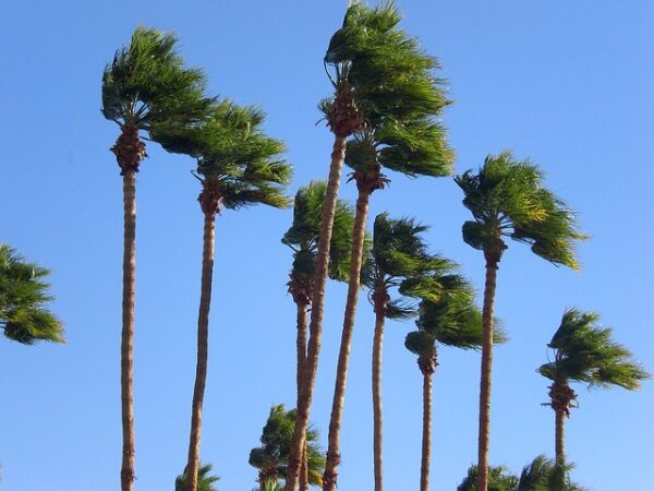
Santa Ana winds were again blowing in parts of the Southland Wednesday, raising concerns about possible wildfires and precautionary power outages in particularly wind-prone areas.
Forecasters said humidity levels will drop sharply by Thursday morning, combining with gusty conditions to raise the fire danger and prompting the National Weather Service to issue a red flag warning of critical fire danger that will be in effect for much of the day Thursday.
“Gusty Santa Ana winds and low humidities will impact portions of Los Angeles and Ventura counties through Thursday,” according to the NWS. “The current north to northeast winds will shift to more northeasterly and peak later tonight into Thursday morning, then gradually decrease Thursday afternoon through Friday. Humidity levels will gradually lower as well. As a result, the chance of reaching six or more hours of low humidity and gusty wind combinations is 20 percent for today but 70 percent for tonight through Thursday.”
The NWS issued a red flag warning that will be in effect from 3 a.m. to 6 p.m. Thursday for the Santa Monica Mountains Recreational Area, the San Gabriel Mountains, the Golden State (5) and Antelope Valley (14) freeway corridors, the Malibu Coast, Calabasas and the San Fernando and Santa Clarita valleys.
Forecasters said mountain areas could see winds of 20 to 30 mph, gusting up to 50 mph. Other areas will likely experience winds of 15 to 30 mph, gusting to 40 mph, with isolated gusts up to 50 mph.
Humidity levels in all areas are expected to fall to 8% to 15% during the warning period, forecasters said.
“A red flag warning means that critical fire weather conditions are either occurring now, or will shortly,” forecasters said. “Use extreme caution with anything that can spark a wildfire. Residents near wildland interfaces should be prepared to evacuate if a wildfire breaks out.”
Most areas of the Southland will have above-normal temperatures Thursday, and while the winds are expected to die down, the warmer conditions are anticipated to last through Sunday thanks to continued offshore flow, according to the NWS. Coastal and valley areas should see high temperatures in the mid-70s to lower 80s over the weekend.
A “dramatic shift” in the weather is expected by early next week, with a possibility of rain in the area by mid-week, according to the NWS.
Meanwhile, however, the dry and windy conditions prompted reminders from Southern California Edison that it may employee Public Safety Power Shutoffs in some areas — cutting power in areas being impacted by winds that could damage power lines and potential spark wildfires.
As of Wednesday morning, none of SCE’s customers were being impacted by such cuts, but more than 68,000 customers in Los Angeles, Orange, Riverside, San Bernardino and Ventura counties were in areas being monitored for possible shutoffs if conditions worsen.
Santa Ana winds due back in Inland Empire
Santa Ana winds will return to the Inland Empire Wednesday and Thursday, generating gusts up to 60 mph in some wind-prone locations, according to the National Weather Service.
The agency posted a wind advisory beginning at 10 a.m. Wednesday and continuing to 2 p.m. Thursday.
“Winds will work south into the Inland Empire and Orange County through Wednesday morning,” according to the NWS. “The (northeast) winds will become strong and gusty … (with) the strongest gusts of 50 to locally 60 mph, most likely Wednesday night in wind-prone canyons and passes.”
The previous Santa Ana wind event spanned three days, beginning Halloween weekend and concluding early last week. Conditions contributed to the rapid spread of a blaze north of Aguanga that consumed nearly 2,500 acres and damaged or destroyed more than a dozen structures, including three homes.
According to surface prognostication charts published by the NWS, a surface trough of low pressure sliding into the region from the north will be the source of the latest event.
Forecasters said low relative humidity will increase wildfire risks again throughout the region.
The low will spin eastward by Thursday afternoon.
The NWS said high temperatures in the Riverside metropolitan area will be in the mid-70s Wednesday and Thursday, with lows in the upper 40s.
In the Coachella Valley, highs will be in the upper 70s, with lows in the low 50s, while in the Temecula Valley, highs will hover in the low 70s, with overnight temps in the mid-40s.
According to meteorologists, forecast models show wet weather arriving sometime next week.