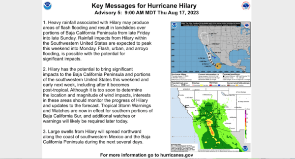
With Hurricane Hilary strengthening to Category 4 status in the Pacific Ocean off the coast of Baja California as it makes its way toward Southern California, a first-of-its-kind tropical storm watch was issued Friday for much of Riverside County.
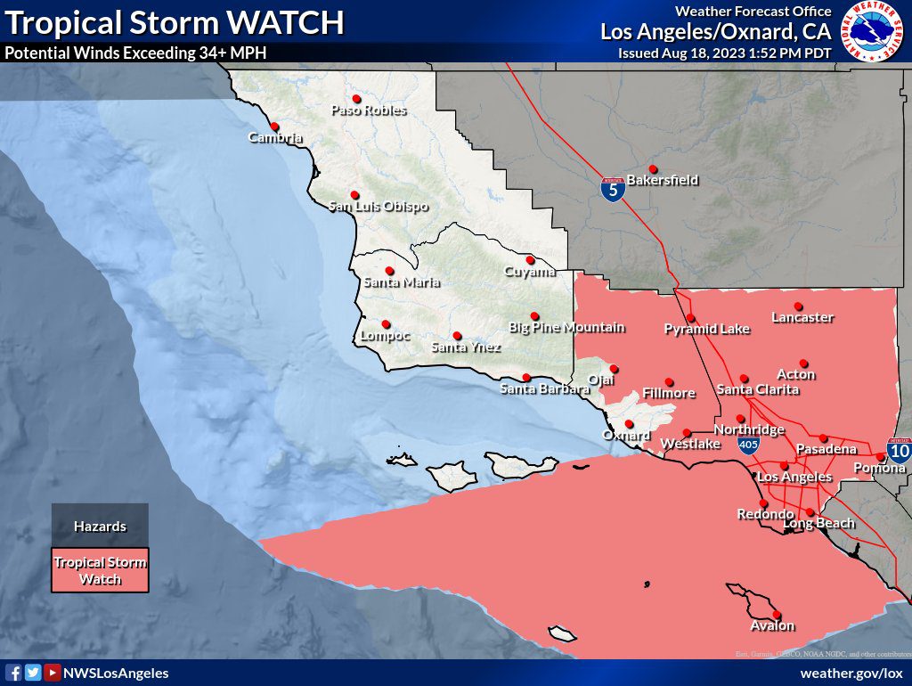
The watch, which indicates that “tropical storm-force winds are possible somewhere within this area within the next 48 hours,” is the first ever issued in Southern California, according to the National Weather Service. A tropical storm has not made landfall in California since 1939, forecasters said.
The watch covers the Coachella Valley, Riverside County mountains and valleys and the San Gorgonio Pass near Banning.
The NWS noted that the hurricane will weaken as it moves north, devolving to a tropical storm as it reaches Southern California over the weekend, but it will still pack a punch, with heavy rain likely to prompt flash flooding in some mountain and foothill areas, along with powerful winds Sunday into Monday.
Forecasters warned that the storm could have major impacts, including:
- flooding that might prompt evacuation orders;
- heavy rain that could turn small streams, creeks, canals, arroyos, and ditches into “dangerous rivers,” leading to potentially destructive runoff in mountain valleys that could raise the risk of rock slides, mudslides and debris flows; and
- flooding of streets and parking lots that will make driving conditions dangerous and potentially prompt road and bridge closures.
Moisture from the storm is expected to start impacting the region as early as Saturday.
“Widespread heavy rainfall is expected for Saturday into Monday with the most widespread and heaviest rainfall expected for Sunday night,” according to the National Weather Service.
The exact path of the storm remained in flux Friday, with forecasters noting that even slight shifts in its track could dramatically impact rainfall totals.
“Regardless of the exact track and intensity of Hilary, which could continue to change in the coming days, it will bring a substantial surge in moisture into Southern California, with heavy rainfall and a high potential for flash flooding, especially for the mountains and deserts,” according to the National Weather Service.
Forecasters said mountains in Riverside and San Diego counties could see 4 to 8 inches of rain, possibly up to 10 inches on some eastern slopes, between Saturday and Monday. Lower desert areas could receive 5 to 7 inches. Coastal areas are anticipated to get between and inch and an inch-and-a-half of rain, with valleys getting 1.5 to 2 inches.
The NWS issued a flood watch that will be in effect from Saturday morning through Monday in the San Diego County mountains, deserts, valleys and coastal areas, along with the Riverside County mountains and valleys, the Coachella Valley and San Gorgonio Pass near Banning.
Forecasters said the heavy rains could result in excessive runoff that might flood rivers, creeks and streams and cause debris flows in recent burn areas.
“In addition to the rainfall and flooding threat, another concern is the potential for strong east winds Sunday and Monday,” according to the NWS. “The wind threat will be more dependent on the track of Hilary. Should Hilary have a more westerly track, the wind threat would likely be greater, and if the track is more easterly, the threat would be less.
“The combination of heavy rainfall, the potential for flash flooding, and strong winds could very well make this a high-impact event for Southern California.”
Palm Springs officials urge residents to prepare for potentially dangerous conditions
City officials Thursday urged residents to prepare for potentially dangerous conditions in Palm Springs due to Hurricane Hilary, which is expected to impact the Coachella Valley with rain, flooding and high winds.
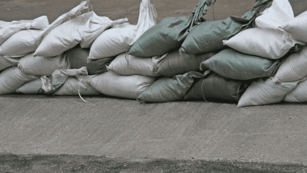
Empty sandbags will be available at five Palm Springs fire stations daily to ensure that residents are prepared for potential flooding, according to Palm Springs Communications Director Amy Blaisdell.
Fire stations located at 277 North Indian Ave., 300 North El Cielo Drive, 590 East Racquet Club Drive, 1300 La Verne Way and 5800 Bolero Road will all have empty sandbags available from 7 a.m. to 8 p.m. daily, Blaisdell said. The pit behind City Hall of El Cielo Drive will also have sand available for pick up.
“If any area is flooded, turn around and never drive around a barricade or road closure because local responders use them to safely direct traffic out of flooded areas,” Fire Chief Paul Alvarado said in a statement. “We want to avoid swift water rescues, which put the lives of both drivers and public safety at risk.”
Alavarado additionally advised residents to take precautions such as avoiding driving during heavy rain and dangerous conditions, staying off bridges over fast moving water, staying inside a car if it’s trapped in rapidly moving water, getting on the roof of a car if water is rising inside, avoiding flood waters and signing up for the city’s public safety alerts.
The storm is expected to yield as much as five inches of rain into Palm Springs and as much as nine inches in the San Jacinto Mountains, potentially leading to a severe mountain run-off, Blaisdell said. What should be expected in the Coachella Valley are some showers Saturday, heavier rainfall Sunday through the evening and the heaviest rainfall Monday morning.
“Residents should know that rain/flood waters can be dangerous and that as little as one inch of water can move a car,” Palm Springs Emergency Manager Daniel DeSelms said in a statement, adding that residents should avoid driving during heavy rain.
Public safety alerts for residents to be notified about road closures and weather-related events will be available at palmspringsca.gov.
Updated Aug. 18, 2023, 11:11 a.m.


