Rain, snow and wind are moving through Southern California Wednesday, flooding freeways and roads and causing mud flow and landslides in neighborhoods in Los Angeles and Orange counties.
The storms have led to power outages and school closures in mountain communities. Homes in La Cañada Flintridge and Beverly Crest were damaged by mud flow and debris resulting in evacuations of some residents.
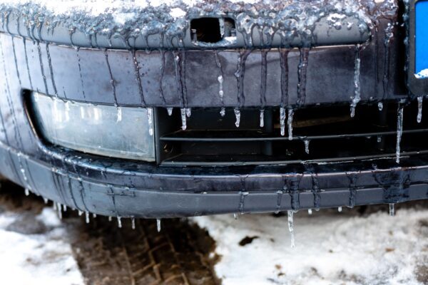
Interstate 5 is closed in both directions because of heavy snow and ice, according to the California Highway Patrol. The northbound and southbound I-5 is closed between Parker Road in Castaic and Grapevine as crews are working to clear the roads of snow and ice. There is no report of when the Grapevine will reopen.
Highway 39 in the Angeles National Forest is closed from Coldbrook Ranger Station to 2 miles north of Crystal Lake Road due to snow, and closed to the junction with Highway 2 for maintenance.
Highway 138 is closed from I-5 to 190th Street West.
Highway 2 in the Angeles National Forest is closed from the border of Los Angeles and San Bernardino counties to Highway 138 due to snow.
Two sinkholes caused by the heavy rains have led to closures Wednesday on roads in Los Angeles County.
A SigAlert has been issued in downtown Los Angeles on the northbound Santa Ana (101) Freeway for a sinkhole in the right lane near Spring Street. Traffic is reportedly backed up to Fourth Street.
Another sinkhole is in the 1200 block of Elden Avenue in the Pico-Union neighborhood. It is about 3 feet wide and “probably about 10 feet deep and open up on the inside,” Sgt. Richard Boyd of the Los Angeles Police Department told KTLA.
“Definitely not a situation that we’re going to let people come near or drive up to,” Boyd said.
A tree was knocked down in Laurel Canyon blocking the road on Lookout Mountain Avenue. City crews were reportedly responding. The storm has toppled trees in Brentwood and Northridge blocking streets in those neighborhoods.
The winter storm is the second of three pushing through Southern California this week, bringing more rain and snow to an already soaked region and prompting the National Weather Service to issue a winter weather warning for Los Angeles County mountains.
Forecasters said the mountains can anticipate “moderate snow through Tuesday afternoon, becoming heavy at times late Tuesday afternoon through Wednesday. Snow total of 8 to 16 inches with local amounts to 24 inches, highest in the eastern San Gabriel mountains. Winds will gust from 40 mph to locally 60 mph at times.”
According to the weather service, snow levels will initially be between 3,000 and 4,500 feet, but the level could drop as low as 1,500 feet by Wednesday.
“Travel could be very difficult to impossible due to reduced visibility due to snow and blowing snow. Mountain roads, including higher portions of Interstate 5 will likely be impacted at times,” according to the NWS. “Snow drifts, especially above 5,000 feet, may be another substantial travel hazard. The weight of recent snow combined with strong winds may down trees and powerlines.”
Southern California was beginning to dry out Sunday from two days of virtually nonstop rain on Friday and Saturday. The powerful winter storm dumped 10.79 inches of rain on Woodland Hills through Sunday morning, 9.29 inches in La Cañada Flintridge, 8.38 inches in Newhall, 8.11 inches in Pasadena, 6.88 inches in Burbank, 6.76 inches in Bel Air and 4.49 inches in downtown Los Angeles, according to the NWS.
Mountain High received 93 inches of snow, and 40 inches dropped on Mount Wilson.
The torrential rains in La Cañada Flintridge prompted a mudslide Sunday that severely damaged at least one home on Paulette Place and raised concerns about additional slides that could occur with more rain.
A hilltop home on Mulholland Drive in Beverly Crest was evacuated on Tuesday. Fire crews and building inspectors evaluated four homes in the neighborhood, but only one was evacuated. Two residents, a man and his caretaker, were staying with neighbors, according to the Los Angeles Fire Department.
A series of three storm fronts will be pushing through the area this week, forecasters said. The weakest of the three was felt in the region early Monday, followed by a secondary front that arrived Monday evening into Tuesday. The early waves of the storm brought some rain, but only at a “moderate” pace compared to the heavy downpours seen late last week.
The strongest front was expected late Tuesday into Wednesday. Forecasters said by the time the storm series ends, most valley and coastal areas would see between 0.75 to 1.25 inches of rain, with some mountain areas receiving up to 3 inches.
“Gusty southwest to west winds are possible for periods of times, especially across the interior portions of the area and mountain areas over the next several days,” according to the NWS.
A high wind warning in the Antelope Valley is in effect until 4 a.m. Wednesday. Forecasters said southwest winds will blow at 25 to 40 mph, with gusts of up to 60 mph.
Meanwhile, thousands of people were without electricity Monday following the powerful storms.
The Los Angeles Department of Water and Power reported Monday afternoon that about 27,000 customers were without power, but crews had restored power to about 143,000 customers who lost electricity during the storms. The utility reported that crews were working around the clock to get the power back on.
A DWP worker was in intensive care after suffering an injury while working to restore power Saturday in the San Fernando Valley, according to the utility.
“This accident and serious injury of our employee is a reminder that our line crews and other field personnel are truly unsung heroes who work in hazardous conditions risking their lives to keep the power flowing across our city,” LADWP General Manager Martin Adams said.
Meanwhile, Southern California Edison’s outage map Monday showed 44 outages affecting more than 2,100 customers across its vast service area, including about 330 in Los Angeles County and about 23 in Orange County.
Los Angeles County health officials continued to warn people to avoid going into the ocean near discharging storm drains, creeks and rivers until at least Wednesday due to the storms. The water might contain bacteria, chemicals, debris, trash and other health hazards.
This weekend was the first time downtown Los Angeles received at least 2 inches of rain on consecutive calendar days since Feb. 28 and March 1 of 1978, according to the NWS.
The weather service added that Friday was the wettest February day at Burbank Airport since records began there in 1939, beating the previous record of 4.50 inches set on Feb. 8, 1993.
Updated March 1, 2023, 10:00 a.m.


