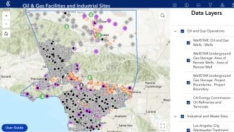
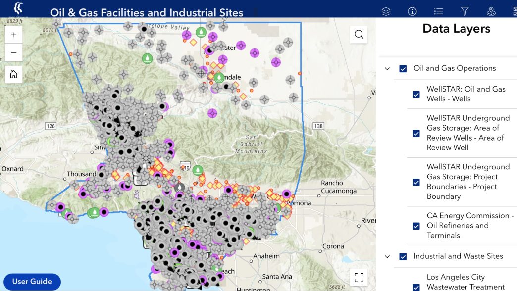
The Department of Public Health announced the launch of a new online map Friday that displays fossil-fuel, industrial and toxic waste sites in Los Angeles County.
The county’s first interactive environmental mapping tool shows more than 6,000 active or idle oil wells and 1,300 industrial facilities, with some situated in or adjacent to residential neighborhoods and public places.
Environmental issues resulting from such locations include excess or loud noise, air pollution, odors or accidental releases, depending on the type of facility and surrounding land uses.
One main section of the mapping tool is for oil and gas, and the other is for industrial and waste sites.
For oil and gas facilities, the internet-based map will provide the location and designations of active, inactive and retired oil wells, underground gas storage facilities as well as refineries and fuel terminals.
The section for industrial facilities and hazardous waste sites provides the location and data on water reclamation plants, legacy pollution or federal Superfund sites, active industrial sites and solid waste sites including landfills, trash dumps and recycling centers.
The mapping tool also details administrative and geographic boundaries, such as unincorporated areas, cities, U.S. Census tracts and county supervisorial districts, green zones or sensitive-use boundaries and service areas for Health Department teams. Officials said these layers are intended to help people better understand how facilities relate to specific communities.
The DPH’s Office of Environmental Justice and Climate Health developed the mapping tool as a part of its ongoing commitment to transparency, health awareness, environmental justice and community engagement, according to the agency.
“Communities should be able to easily see clear information about what is in their neighborhoods,” DPH Director Barbara Ferrer said in a statement. “This tool brings multiple sources of information together so people can better understand what may be affecting their health, make informed decision, and support community planning that benefits everyone in the county.”
The map is accessible on the county’s website.