A strong storm system moving through Los Angeles and Orange counties Wednesday evening into Thursday was forecast to drop a large amount of rain over a short time period, prompting evacuation orders, flood warnings and road closures.
With nearly an inch of rain per hour possible during the storm’s peak, evacuation warnings and address-specific evacuation orders were in place for neighborhoods susceptible to mudslides, including recent burn areas, the Los Angeles Fire Department officials said Tuesday.
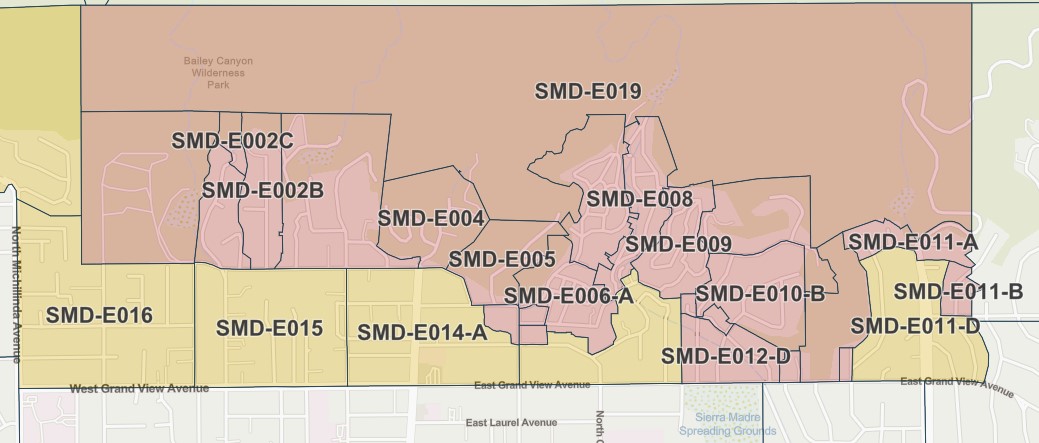
Sierra Madre city officials also issued evacuation orders and warnings Wednesday for foothill areas. They can be found at sierramadreca.gov, which connects to an online map that uses coded designations to identify evacuation areas.
All evacuation orders and warnings were in effect from 7 a.m. Wednesday to 6 p.m. Thursday.
Officials said the following burn areas were especially vulnerable to heavy rain:
- Palisades Fire: Getty Villa area, Highlands near the burn areas, Bienveneda area near Temescal Canyon Park, Rivas Canyon/Will Rogers State Park area, Mandeville Canyon above Tanners Road, Old Ranch Road and Rustic Creek;
- Sunset Fire: East and south of Runyon Canyon; and
- Hurst Fire: Olive Lane in the Oakridge Mobile Home Park.
Homes in the warning area with high risk received specific evacuation orders Tuesday from Los Angeles Police Department officers.
In Orange County, officials issued evacuation warnings for areas in the Trabuco Canyon, Hot Springs Canyon, Bell Canyon, Long Canyon and Modjeska Canyon ahead of possible debris flows near the Airport Fire burn scar.
“A fast moving cold front will blast through the area overnight with most of the steady rain finished by 8 a.m. Thursday, if not sooner,” the National Weather Service reported. “Despite the relatively fast speed, the system will pack quite a punch with a 60-80% chance of hourly and/or sub-hourly rates to exceed debris flow thresholds somewhere in the foothills and mountains and possibly in other areas as well.
“Thursday will be a mixed bag of weather conditions with rapidly lowering snow levels, increasing air mass instability with isolated thunderstorms, as well as periods of no rain and some sunshine,” according to the NWS. “Rain could be very heavy at times with small hail and snow as low as 2,500-3,000 feet. Travel over some of the mountain passes may not be possible at times and travel delays and closures should be expected.”
The rain is expected to linger into Friday before clearing up this weekend.
The National Weather Service reported a tornado passed through Pico Rivera around 3:15 a.m. Thursday. Its 1-mile path was 80 yards wide with a two-minute duration and wind that reached 85 mph. The brief twister uprooted trees and damaged cars parked on streets.
Flooding occurred on LA-area freeways Thursday. The California Highway Patrol reported significant flooding in Pomona on the connector road from the westbound Pomona (60) Freeway and the southbound Chino Hills (71) Freeway. Flooding was also reported on the connector road from the southbound Harbor (110) Freeway and the eastbound Glen Anderson (105) Freeway.
In El Monte, a flood closed lane No. 4 on the westbound San Bernardino (10) Freeway near the Peck Road exit.
Wet road conditions led to several traffic incidents. A white Tesla ran off the road at the Lower Azusa Road exit of the southbound San Gabriel River (605) Freeway in Irwindale, and in Lynwood a black Toyota Tacoma spun out and collided with a freeway divider on the westbound Glenn Anderson (105) Freeway at the Long Beach Boulevard exit.
Power outages were reported in Altadena near the Eaton Fire burn area.
LA Mayor Karen Bass said Wednesday morning that the city’s Emergency Operations Center has been activated to a Level 2.
“While we prepare for another storm headed towards LA, I want to urge Angelenos to stay vigilant, especially in burn scar areas,” Bass said in a statement, adding that Angelenos should “heed all evacuation warnings, stay vigilant and stay informed.”
In a statement Wednesday evening Bass noted storm preparation efforts by city agencies.
“This storm has the potential to cause impacts in burn areas but also neighborhoods citywide,” she said. “City crews have installed thousands of concrete barriers and thousands of sandbags to stop mudflows. The Fire Department has prepositioned swift water rescue and urban search and rescue teams, bulldozers and other resources. LADWP crews are activated to respond to power outages. LAPD officers are checking on critical infrastructure and are ready to facilitate evacuations.”
The Orange County Public Works Department reported the storm caused rocks, large tree sections and several inches of mud on Trabuco Canyon Road.
In addition to the evacuation orders and warnings, a flood watch was in place from 6 p.m. Wednesday to 6 p.m. Thursday.
Caltrans planned to restrict access for residents and businesses along a portion of Pacific Coast Highway in burn scar areas starting at noon Wednesday because of concerns about the incoming storm. Only emergency responders and fire debris haulers will be allowed through the closure.
Residents with homes in the burn scar area should consider alternate routes in the afternoon hours or consider teleworking if possible, officials said.
LA Metro officials said bus Line 134, which travels through Malibu and Santa Monica, would be canceled at noon Wednesday until further notice.
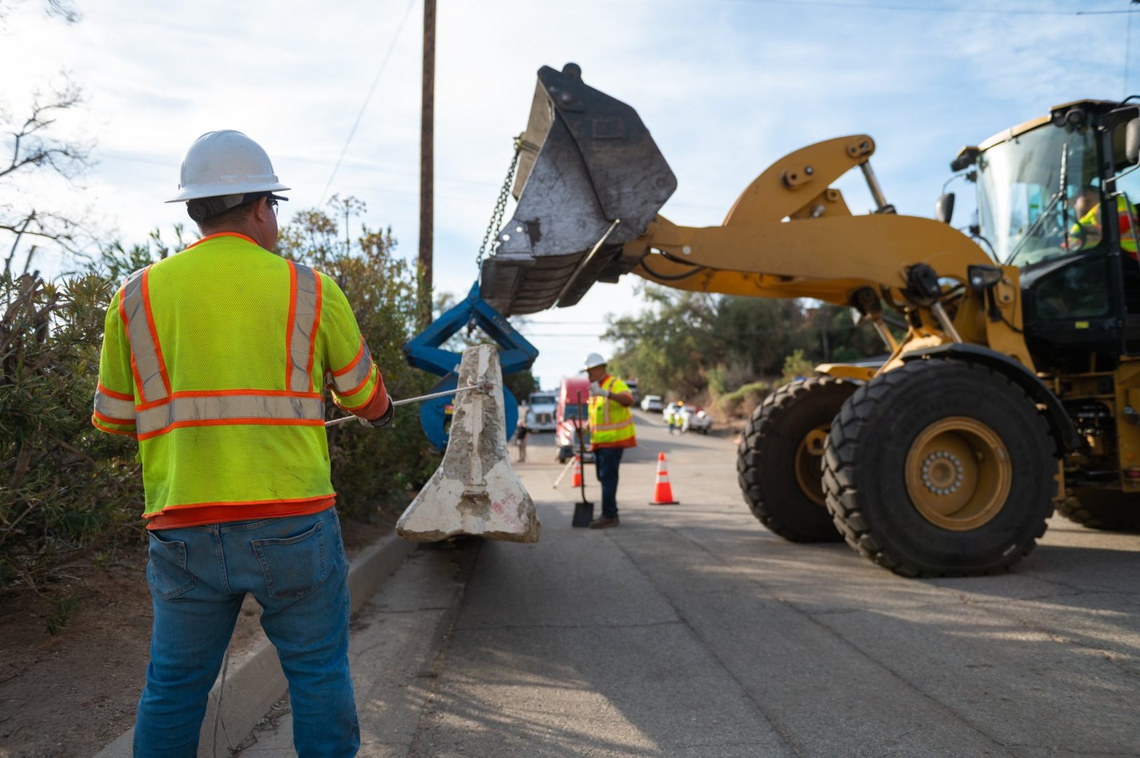
LA County Public Works crews have prepared debris basins, stabilized slopes and reinforced drainage systems to lessen flood risk, particularly in recent wildfire areas including Eaton, Palisades, Bridge, Hurst, Kenneth, Hughes, Sunset, Lidia and Franklin, officials said.
“While these efforts reduce flood risk, the storm could still bring moderate debris and mudflows to burn areas, potentially blocking streets and threatening structures depending on their location and the local terrain,” according to the department, which has mobilized 24/7 storm patrols.
LA County’s Mudflow Advice Hotline, 800-933-0930, fields questions regarding debris flows or flooding. For storm preparedness tips, residents can go to ready.lacounty.gov.
Health officials also warned the public to avoid the water at all Los Angeles County beaches until at least Friday at 4 p.m. due to anticipated high levels of bacteria from the rain.
Long Beach was preparing for potential flooding, particularly in low-lying areas in the peninsula and Alamitos Bay. Sandbag are available for all residents through Thursday at all of the fire department’s neighborhood stations.
Rainfall is expected to total between 1 and 2 inches along the coast and in valleys and 2 to 4 inches in the foothills and mountain areas. Rainfall rates could reach up to 0.75 inches per hour.
The storm system is also likely to deliver the most snow so far this season, with 1 to 2 feet forecast for higher elevations.
Snow levels will initially hold above 6,000 feet, but drop to as low as 3,000 feet by Thursday night or Friday morning, when the disturbance spins eastward, according to the NWS. Snowfall estimates above 6,500 feet are 8 to 12 inches, with up to 24 inches possible above 7,500 feet.
Clear and mild conditions are forecast for the weekend.
Stronger, gusty southwest to westerly winds will develop Wednesday night and continue through Thursday night, the NWS reported.
Daytime highs were expected to drop to about 60 degrees in downtown LA on Wednesday and around 55 on Thursday and Friday. Overnight were forecast to be in the 40s and low 50s. Temperatures were expected in the 30s on Thursday and Friday in the mountains and the Santa Clarita and Antelope valleys.
Health officials warned the public to avoid the water at all LA County beaches until at least 4 p.m. Friday because high levels of bacteria were expected due to the rain.
Updated March 13, 2025, 10:11 a.m.