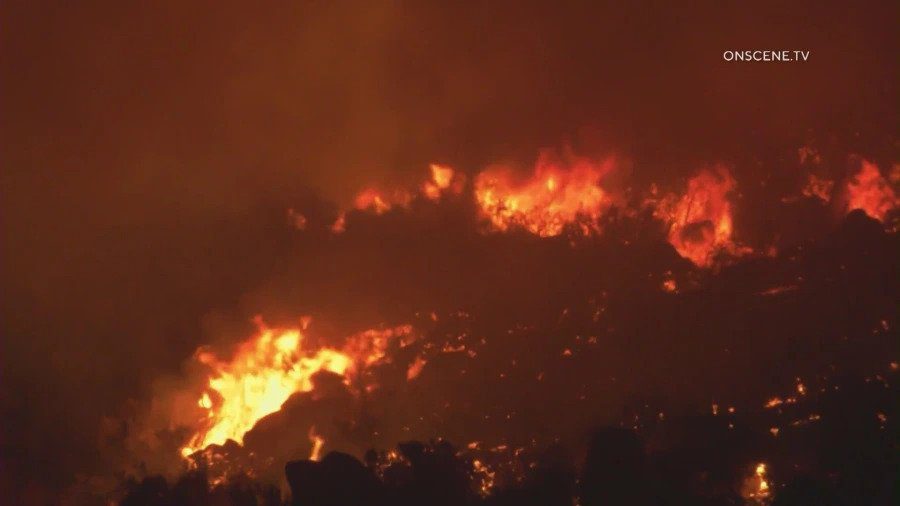
With Southern California entering a 10th straight day of a prolonged heat wave, a tropical storm is bringing heavy rains and strong winds Friday and could create dangerous conditions in recent burn areas.
The state’s power regulators avoided rolling blackouts Thursday by asking all residents to conserve electricity during the hours of 3 to 10 p.m., extending the previous Flex Alerts by two hours.
But an end to the heat wave is finally in sight, thanks in part to Hurricane Kay, which is moving along the coast of Baja California and expected to bring clouds and possibly rain to the area by the weekend.
Flex Alerts issued by the California Independent System Operator, which manages the state’s power grid, have been running every night during the heat wave from 4 to 9 p.m., urging residents to eliminate unnecessary power usage and prevent strain on the system. Thus far, the power grid has held firm, and no rotating blackouts have been implemented.
Cal-ISO extended Thursday’s Flex Alert from 3 to 10 p.m. “because market deficiencies are projected during that time frame,” according to the agency.
The agency also issued an Energy Emergency Alert 2 on Thursday, which will be in place until 9 p.m., signaling that Cal-ISO is requesting emergency power supplies from all resources to meet anticipated heightened demand.
During the Flex Alert, residents are asked to save power by:
— setting thermostats to 78 degrees or higher;
— avoiding use of major appliances;
— turning off unnecessary lights; and
— avoid charging electric vehicles.
Residents were also advised to pre-cool their homes as much as possible and close blinds and drapes to keep interiors cool.
The voluntary conservation measures have worked so far, although the state was on the verge of rolling blackouts on Tuesday evening. Just before 6 p.m. Tuesday, the state moved into an Energy Emergency Alert 3, calling for maximum conservation efforts while warning that blackouts could be imminent without reduced demand.
To drive home the situation, alerts were sent to cell phones across the state urging people to “conserve energy now to protect public health and safety,” and warning that “power interruptions may occur unless you take action.”
But with residents responding to the conservation call, officials ended Energy Emergency Alert 3 at 8 p.m. Tuesday, declaring “consumer conservation played a big part in protecting electric grid reliability.”
Late Tuesday afternoon, statewide electricity demand reached 52,061 megawatts, breaking the record of 50,270 MW set in 2006, according to Cal-ISO.
Southern California has seen temperatures soar above 100 degrees every day since Wednesday of last week. Los Angeles International Airport reached 97 degrees on Thursday, breaking the record for the date of 93 degrees, set in 1984.
It was 103 in Anaheim on Thursday, breaking a record of 102 set in 2015. It was 95 in Newport Beach, breaking a record of 90 set in 1984.
A number of high minimum temperatures were recorded throughout Orange County. It was 75 in Anaheim, breaking the record minimum temperature of 74 set in 2015. It was 74 in Santa Ana, breaking the record minimum temperature of 73 set in 2014.
Excessive heat warnings will be in effect through 8 p.m. Friday for the inland coastal area including downtown Los Angeles, the Santa Monica Mountains and the San Gabriel, San Fernando and Santa Clarita valleys. The warnings will expire at 8 p.m. Thursday in the Los Angeles County mountains and Antelope Valley. Los Angeles County beaches and the Malibu coast will be under excessive heat warnings only on Friday, from 10 a.m. to 8 p.m., according to the National Weather Service.
The excessive heat warning was extended until at least 8 p.m. Friday for Orange County coastal and inland areas, including valleys in San Bernardino and Riverside, and the Santa Ana mountains and foothills.
“Drink plenty of fluids, stay in an air-conditioned room, stay out of the sun, and check up on relatives and neighbors,” the NWS urged. “Young children and pets should never be left unattended in vehicles under any circumstances.”
Forecasters also urged residents to be aware of the signs of heat stroke and to take precautions.
Cooling centers for Los Angeles County can be found at ready.lacounty.gov/heat/. Cooling centers for Los Angeles can be found at emergency.lacity.org/la-responds/beat-heat, or by calling 311.
But relief from the heat appears to be on the horizon thanks to Kay, the effects of which could reach the Southland by Friday evening.
“Warm and muggy conditions are expected through Saturday as Kay weakens and moves north,” according to the NWS. Showers and isolated thunderstorms are expected, especially late Friday into Saturday with some periods of heavy rain possible. Then decreasing chances Sunday with slightly warmer temperatures. Temperatures will remain near or slightly below normal next week.
The NWS issued a statement regarding Tropical Storm Kay warning it will bring steep seas and gusty east winds to coastal waters through Saturday.
Gale force winds are expected at Catalina and San Nicolas Islands, with a chance of winds reaching 20 to 30 knots north to Point Conception and the Channel Islands.
The NWS says to not consider any east facing island harbor, including Avalon Harbor, safe through Saturday, and recommends delaying any plans until Sunday, when fairer weather is expected.