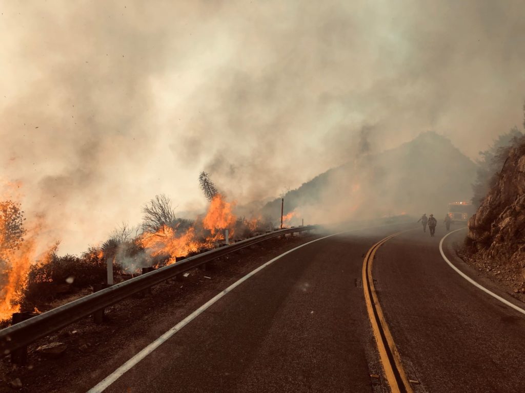
The Bobcat Fire has burned 105,345 acres as of Monday, making it one of the largest fires in Los Angeles County’s history. The fire, which has been burning for over two weeks, remains at 15% containment.
Although evacuation warnings have been lifted for several foothill communities in the San Gabriel Valley, several other county residents remain under evacuation orders and warnings. As of Monday morning, evacuation orders were in place for:
- Residences along Angeles Crest Highway, between Angeles Forest Highway and Highway 39.
- The unincorporated areas of Juniper Hills, Devils Punch Bowl, and Paradise Springs.
- The unincorporated areas of Crystal Lake, east fork of the San Gabriel River, and Camp Williams.
- South of Highway 138, north of Big Rock Creek, east of 87th St. East, and west of Largo Vista Road.
- South of 138th St. east, North of Big Pine Highway and Highway 2, east of Largo Vista Road, and west of 263rd St. east.
- South of Highway 138, north of East Ave. W-14, east of 155th St. East, and west of 165th St. East. (Clear)
Evacuation warnings were also in place for:
- City of Pasadena.
- Unincorporated communities of Altadena and Wrightwood.
- South of Pearblossom Highway, east and north of Angeles Forest Highway, north and west of Mt. Emma Road, east and south of Highway 122, and west of Cheseboro Road.
- South of Highway 2, north of Blue Ridge Truck Trail, east of Highway 39, and west of the Los Angeles County border.
- South of Ave. U-8, north of East Ave. W-14, east of 121st East, and west of 155th St. East.
- South of Pearblossom Highway (Highway 138), south and east of Pearblossom Highway (Highway 122), north and west of Mt. Emma Road, north and east of Angeles Forest Highway, and west of Cheseboro Road.
- South of Mt. Emma Road, north of Upper Big Tujunga Canyon Road, east of Angeles Forest Highway, and west of Pacifico Mountain.
On Sunday, “The fire west of Mt. Wilson made a northerly push towards Highway 2, firefighters were able to keep this in check. The north end towards the Antelope Valley continued to grow to both the west and east.” Crews also successfully put out a spot fire in Santa Anita Canyon near Chantry Flat.
According to officials from the Angeles National Forest via tweet Monday, the fire remains most active around Mt. Wilson, Chilao and Little Rock Creek. Firefighters will work to slow westward spread using defensive strategic firing, line construction and aircraft drops throughout Monday. Early in the day, fixed-wing aircraft was grounded due to a drone incursion.
Fire engines, hand crews and aircraft were working on picking up spot fires north of Mt. Wilson just before noon.