Firefighters continued making progress Tuesday to contain the three large brush fires in Southern California that collectively have burned more than 117,000 acres in Los Angeles, Orange, Riverside and San Bernardino counties.
Fire officials expected the 23,519-acre Airport Fire in Orange and Riverside counties to be fully contained before Wednesday after achieving 88% containment.
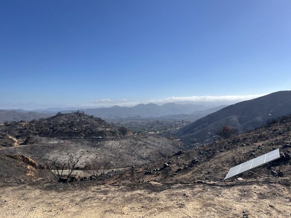
The Bridge Fire in LA and San Bernardino counties has burned 54,878 acres and was 79% contained, according to Cal Fire on Tuesday morning. It is the state’s largest active blaze, followed by the 39,232-acre Line Fire in San Bernardino County. The Line Fire was 75% contained Tuesday.
Bridge Fire
“Mop-up efforts continue today with crews strengthening primary & secondary containment lines and removing hazardous trees near Wrightwood, Grassy Hollow & Big Pines Highway,” Angeles National Forest officials said Tuesday in a statement on X.
The fire is located in the Sheep Mountain Wilderness and had threatened 4,409 structures. It has destroyed 81 structures and damaged 17 others, according to Cal Fire.
Eight injuries were reported.
Fire officials warned that warm and dry conditions were forecast to return this week, which could hinder containment efforts.
Firefighters will continued mop-up efforts across the fire, securing containment lines, extinguishing isolated heat sources and knocking down hazardous trees for improved safety, according to a Cal Fire statement Monday. Crews on the west flank focused on an area from Rattlesnake Peak north and Mount Baden Powell south and tied containment lines at Mount Hawkins. On the south flank, aircraft dropped fire retardant and worked with ground crews “to get that area buttoned up.”
The Bridge Fire started shortly after 2 p.m. on Sept. 8 near East Fork and Glendora Mountain roads, according to forest officials. The fire initially remained relatively small, but exploded to a massive size at the end of an extensive heat wave Sept. 10, destroying many homes and buildings as it swiftly spread into San Bernardino County.
Road closures were in effect at:
- Big Pines Highway;
- Big Rock Creek Road;
- Largo Vista Road;
- Mescal Creek Road;
- Panorama Motorway;
- State Route 39 at the base of San Gabriel Canyon;
- Glendora Mountain Road north of Big Dalton Road; and
- Westbound state Route 2 at Flume Canyon Road.
There were 1,056 personnel assigned to battle the blaze, including 63 crews, 15 helicopters, 17 water tenders, 31 dozers and 120 engines, according to Cal Fire on Tuesday morning.
A unified command of Cal Fire San Bernardino, the Angeles National Forest, Los Angeles County Fire Department, Los Angeles County Sheriff’s Department, San Bernardino County Fire Department and San Bernardino County Sheriff’s Department were coordinating firefighting efforts.
Command of firefighting operations will transfer on Wednesday from a California Interagency Incident Management Team back to the Angeles National Forest.
The cause of the Bridge Fire is under investigation.
Line Fire
The Line Fire near Highland in San Bernardino County has caused four injuries, destroyed one structure and damaged four, according to Cal Fire.
The Line Fire erupted Sept. 5 near Base Line Road and Alpin Street in Highland, according to Cal Fire.
An evacuation order was in effect from Sept. 20-Nov. 30 for a “forest closure area” around the Line Fire that includes all Angeles National Forest lands, trails and roads closed to the public within that zone, including the San Gorgonio Wilderness.
Highway 330 is closed northbound from Highland Avenue to Live Oak.
A total of 1,750 firefighting personnel were battling the blaze Tuesday.
Airport Fire
Containment of the Airport Fire in Orange and Riverside counties increased rapidly overnight from 74% to 81%, state fire officials said Monday. On Tuesday containment rose an additional 7%.
Injuries totaled 22, and the fire has destroyed 160 structures and damaged 34 as of Tuesday, according to Cal Fire.
The Airport Fire started near Trabuco Canyon Road in the area of a remote-controlled airplane airport, OCFA Capt. Sean Doran said. Officials determined the fire was caused accidentally by an Orange County Public Works Department crew using heavy equipment.
Road closures include:
- Trabuco Canyon Road and Trabuco Creek Road
- Silverado Canyon and Maple Springs
- North Main Road and Ortega Highway
- Long Canyon Road and Ortega Highway
“A closure order is in effect for the Trabuco Ranger District of the Cleveland National Forest,” officials said. “Firefighters have observed hikers and mountain bikers in the area. Please do not enter the closure area or recreate on any of the firelines constructed for the incident.”
Southern California Edison has announced plans to replace damaged power poles and lines starting Tuesday along the Ortega Highway, fire officials said. Helicopters will transport and place the poles. Officials said the pole replacement will happen during times of minimal highway use, but traffic delays may “occasionally occur for extended periods.”
Personnel involved in the firefight totaled 584 Tuesday, according to Cal Fire.
More information on the three wildfires, including updates on roads and evacuations, is at fire.ca.gov/incidents.
Updated Sept. 24, 2024, 3:13 p.m.