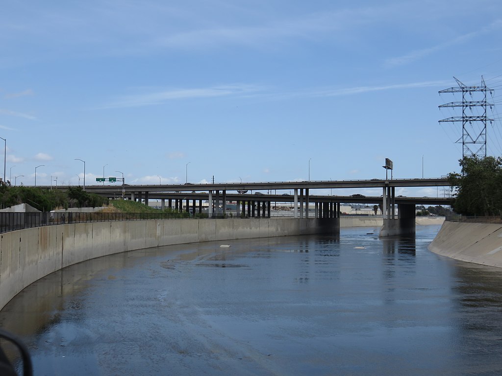
Los Angeles County Tuesday unveiled its final Los Angeles River Master Plan, which the county’s Board of Supervisors will consider for adoption on June 14.
The plan is aimed at improving water quality, increasing wildlife habitat and biodiversity and creating equitable access to parks. Among its specific goals are:
— creating 51 miles of connected open space along the entire river;
— building support facilities along the river;
— completing the L.A. River Trail to create a continuous path along the entire river;
— creating welcoming access points to the river and the L.A. River Trail;
— increasing safe transportation routes to the river;
— increasing habitat and ecosystem function along the river corridor and using it as a living laboratory;
— increasing plant species biodiversity with a focus on California native plants; and
— creating a connected network of habitat patches and corridors to support wildlife.
“The LA River Master Plan outlines critical investments throughout the 51 miles of the river and supports our river-adjacent communities,” Supervisor Hilda Solis said. “Once adopted, this plan will ensure that every LA County resident has equal access to the river while improving our local water supply and expanding parks and open space, trails, and more.”
The plan unveiled Tuesday is an update to the original master plan, which was drafted in 1996 with the goals of flood abatement and beautification. In 2016, Solis and Supervisor Sheila Kuehl spearheaded a motion to update the plan with a focus on addressing the county’s societal needs. The process included community engagement through a 41-member steering committee, more than a dozen public community meetings and 15 events coordinated with 10 community organizations.
“The LA River is an incredible natural resource, but it was never designed to serve the recreational and environmental needs of our river- adjacent communities or the county as a whole,” Kuehl said. “This final version of the LA River Master Plan brings the potential of the river up to date by establishing a thoughtful, comprehensive road map that creates a 51- mile artery of sustainable and healthy habitats for plants, animals and people.”
The L.A. River begins in Canoga Park where Bell Creek and Arroyo Calabasas converge, and runs through the city of Los Angeles and over a dozen other cities before it flows into the Pacific Ocean in Long Beach.
The plan’s update, overseen by L.A. County Public Works, intends to ensure improved river access and ecosystem support, while also seeking to support COVID-19 recovery, mitigate housing shortages and address concerns about housing inaffordability.
The plan — which has been met with concerns that it will accelerate gentrification along the river — calls for an increase in affordable housing units within a mile of the river, and seeks to develop ways to identify areas at risk for displacement in order to prioritize such projects. The County’s Affordable Housing Coordinating Committee would also advise on housing stabilization strategies along the river.
“We explored areas of social, cultural, and ecological disparity, including homelessness, gentrification, public open space, public health, and community and environmental inequities in infrastructure,” said County Public Works Director Mark Pestrella, who is also the chief engineer of the Los Angeles County Flood Control District. “The result is a plan that recognizes the river as a complex `system of systems’ in which people, places and the environment are encouraged to coexist, intermingle and thrive.”
Renowned architect Frank Gehry and landscape architect Laurie Olin are among those involved in the process and have supported a team that the county says prioritized maintaining the diversity of communities that live along the river.
“The LA River has had several big transformations over the years,” Gehry said. “It has been a privilege to collaborate with public officials and organizations to imagine a more equitable future for the folks who live along the river by using it to help heal the environmental and socio-economic inequities that seem to follow alongside the path of the river.”
In January 2021, a revised draft of the updated master plan was published — the first update in 25 years and the only plan encompassing all 51 miles of the river. Once a final plan is adopted by the Board of Supervisors, it will serve as a toolkit for potential projects along the river and improve funding opportunities to get the projects off the ground, according to the county.
“The LA River Master Plan prioritizes public investment in historically underserved communities and serves as a guide for projects that promote park access, community and ecological health, and resilience in the face of climate change,” said Jessica Henson, partner at the landscape architecture firm OLIN, which is collaborating with the county.
People can learn more about the plan at LARiverMasterPlan.org.

