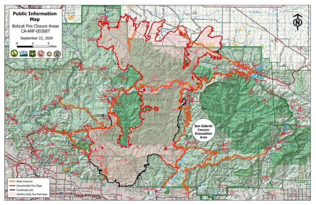
The Bobcat Fire has burned 109,271 acres and is 17% contained as of Tuesday morning.
The fire remained active Monday in the western, northern and southwestern portions. Evacuations were issued for the areas near Colby Ranch and Hidden Springs, where crews worked to prepare structures and build contingency lines. Crews also began a strategic firing operation moving north from Mount Wilson to Highway 2 that continued throughout the night. Minimal fire activity occurred on the southern and eastern sides from Mount Wilson around to Crystal Lake.
Similar fire activity is expected for Tuesday. The defensive strategic firing operation to secure the line between Mount Wilson and Highway 2 will continue and is expected to be completed Tuesday. The U.S. Forest Service warned residents Tuesday that a large plume of smoke will be visible near Mt. Wilson but that it is from a strategic defensive operation in the area to keep the fire from jumping Highway 2. The south side and Highway 39 corridor continues to be in mop up and patrol status.
An evacuation order was issued Monday for residents near Camp Colby and includes the areas east of Angeles Forest Highway, west and south of Upper Big Tujunga Canyon Road, and north of Angeles Crest Highway. Other unincorporated areas that remain under evacuation orders include the areas and communities of Big Rock Wash, Littlerock/Pearblossom, Crystal Airport, Valyermo, Ft Tejon Road, Camp Williams, Juniper Hills, Cruthers Creek, Devils Punchbowl, Cima Mesa, and near Paradise Springs.
Evacuation warnings remain near the areas and communities of Pacifico Mountain, the area north of Mt. Emma Road, as well as Littlerock Wash, Longview, and Wrightwood. An evacuation warning remains in effect as a precaution for Pasadena residents in foothill neighborhoods north of Sierra Madre Boulevard. For more information on evacuation orders, visit inciweb.nwcg.gov.
The Los Angeles County Department of Animal Care and Control continues to provide safe sheltering for animals affected by the Bobcat Fire. Livestock is being accepted at the Antelope Valley Fairgrounds and companion animals are accepted at the Baldwin Park Animal Care Center, Palmdale Animal Care Center, and the Lancaster Animal Care Center.
So far, the fire has destroyed at least 29 structures in northeastern section of the county and that number might possibly increase to 85.